I am Associate Professor and Graduate Director in the Department of Culture, Arts, and Media at Trent University. I am a Managing Editor at Media Theory, a peer-reviewed, open-access journal, and Regional Editor (Central Canada) at the Canadian Review in Comparative Literature. I also sit on the Advisory Board of the Canadian Association of Cultural Studies.
My research draws from both media and geography to examine how experimental and socially engaged art reveals critical issues for cities, technology, politics, and visual culture. My forthcoming book focuses on artistic networks that developed around newly available geospatial technologies at the turn of the century, revealing an under-researched case study in the debate over practice-based methods in today’s higher ed.
I am on sabbatical until June 30, 2026.
Past research (2005-20)
Questions of space have figured prominently since my first days in graduate school at Western University’s Centre for the Study of Theory and Criticism (2005-7), where I wrote a master’s thesis exploring political subjectivity and its spatial dimensions in works by Giorgio Agamben, Alain Badiou, and Jacques Derrida. However, growing impatient with the demand for pure textual analysis and hermetic thinking at the Centre, I made the decision to pursue a Ph.D at York University in the Department of Humanities (2007-15), where I focused on articulations of contemporary European culture and migratory art. Highlighting archival lieux des memoire including architecture, film, literature, and sculpture, my dissertation situated new imaginaries of European “home” as a critical response to the upheavals of the 2008 financial crisis. The artistic works I chose to focus on supported a broader investigation into memorialization practices as read through the prism of critical race and ethnic studies. As I argued, second generation migrants are uniquely situated to hold European memory institutions accountable for the “translocal” specificity of diverse communities (El-Tayeb 2011).
After graduating with my Ph.D, I published articles on archiving, cultural memory, art history, counter-memorialization, libraries and architecture, and cities. During this time, I also revisited a prior interest in media theory and explored various media-geographical entanglements. My first article on this subject looked at digital media in relation to mapping representations and politics. In “The Geospatial Rhetoric of Asylum: Mapping Migration in Fortress Europe,” I sought to expose the impact of geospatial imaging technologies on relations between users, interfaces, and publics. I analyzed an online map created by neo-fascists which contained geospatial details of asylum houses throughout Germany built in response to the Syrian refugee crisis. I uncovered how the group’s information gathering tactics reflected long contested relationships between maps, power, and the construction of identity. I made further note of a suspicious alignment between anti-migrant sentiments and the map’s presumed objectivity, and I questioned the viability of cementing demands for social justice through an appeal to facts. I addressed the epistemic assumptions behind rejecting politically motivated maps as propaganda, the logistical and strategic novelties associated with crowdsourcing through social media, and the narrative power of maps.
This work inspired me to examine a broader constellation between the arts, media, cartography, and cities. In “Geospatial Detritus: Mapping Urban Abandonment,” I explored how digital mapping visualizations help to transform abandoned cities into motors of sensory experience, sociality, and public initiative. Heralding the onset of “austerity urbanism” (Tonkiss 2013), I situated artworks like Michael Heizer’s City as a watershed for resisting demands to mobilize a digital tourism industry of abandoned places. Later, in “Geolocating Popular Memory: Recorded Images of Hashima Island after Skyfall,” I described how Japan’s Hashima Island as featured in a James Bond film spurred efforts by Google to produce images of the island’s built environment with the help of an experimental “Trekker” device. I explored how this image archive was applied to support Japan’s contested bid for UNESCO industrial heritage status. This status protects the island as an historic site of technology and Meiji-era industrialization, despite loud objections from the Korean families of long-forgotten conscripted workers.
Altogether, these various projects inspired me to develop a special journal issue exploring questions of Geospatial Memory. With a focus on aesthetic, cultural, historical, and archival objects, I compiled a volume of 17 contributors with an aim to explore how geospatial media helps to shape our current spatial orientation toward the everyday and to the past. The contributors and I found diverse and often unique ways to infuse the practices of collective memory into the experiences, discourses, and technologies of geospatial media, drawing on film and archival studies, psychogeography, urban studies, media archaeology, critical methods, and communications.
Recent research (2021-25)
My research during COVID faced predictable challenges. In the first year of the pandemic, I became actively engaged with colleagues both at Trent and beyond to explore various initiatives and funding proposals. Generally, however, the pandemic delayed completion of several existing projects. My edited volume of the Canadian Review in Comparative Literature, which included papers delivered at annual meetings of the Canadian Comparative Literature Association (CCLA) during my tenure as President (2018-20), was delayed. Initially scheduled for publication in the fall of 2020, the volume was released almost two years later with my introduction entitled “Comparative Studies in a Precarious Present.”
In 2021, I wrote an article examining questions of media philosophy and media specificity in Harun Farocki’s Parallel, the German documentary filmmaker’s last completed work before his death in 2014. My paper, entitled “‘Where Does This World End?’ Space, Time and Image in Harun Farocki’s Parallel,” offers a meditation on the ontological status of digital images, exploring the latter’s impact both on documentary filmmaking and on adjacent narrative-based approaches. Much of my analysis of Parallel focuses on “non-vococentric” methods of essay film storytelling, and on the challenges of applying critical approaches in Media Studies, such as media archeology, to popular visual culture (Harvey 2012). I presented on this research following an invitation from CCLA’s Materialities Research Group in March 2021. However, because of pandemic delays, the completed article was not published until December 2023.
Also in 2021, I was approached by the editors of the forthcoming Bloomsbury Encyclopedia of Visual Culture to write an article-length entry on “Digital Geographies” for Volume 3, entitled Digitisations, Transformations, and Futures. This is scheduled for publication in 2026.
In 2020 and again in 2021, I was awarded two SSHRC Explore Grants from Trent University valued at $7,000 and $5,000, respectively. The first, building on years of prior research, was devoted to probing the myriad connections between ecology, infrastructure, and mobility in communication theory. This research was mainly conducted through a review of the diverse literature on these subjects. The second grant, more narrowly focused than the first, was geared to examining the methodological and practical challenges involved in creating an open-access repository of “locative art,” which I define as artwork that directly engages locative media (i.e., smartphones, sensor devices, and Geographical Information Systems or GIS). This research was conducted through a critical evaluation of existing open-access repositories and their rapidly changing platforms and infrastructures, and through interviews with academics, librarians, and technicians.
With the aid of this generous funding, I found myself in a position to apply for a SSHRC Insight Development Grant (IDG) in 2022, in which I proposed to build a prototype repository of digital locative art – the first of its kind. The design of the repository was to be mindful not only of the ephemeral quality of locative art, given the medium’s dependency on user experiences, but also the geographical specificity of the artform. Both aspects reveal specific challenges for archiving and digital preservation. I partnered with Dr. Jill Didur, my colleague at the Milieux Institute at Concordia University, who agreed to serve as Co-Applicant. I also partnered with a half dozen artists and technicians around the world, including from the U.K., Spain, Turkey, Canada, and the United States, who agreed in principle to serve as Collaborators. Unfortunately, the application was unsuccessful.
My current research has been anchored by several, recently completed projects:
The first project of note was inspired by the thoughtful questions of students taking my workshop in Computational Arts over the years, and by a personal impetus to reanimate the art-historical themes that I explored during my Ph.D. Initially, these questions concretized in an investigation about how practice-based humanities research commits to participate in the evolving forms of knowledge that are recognized at universities. In 2023, together with Dr. Agata Mergler, a colleague of mine at York University, I sought to develop a community of researchers who are equally invested in these issues by organizing a conference at Trent under the theme of A Research-creation Episteme: Practices, lnterventions, Dissensus.
Bringing together practitioners, artists, faculty, and students, the conference hosted more than 30 speakers tasked with building a collection of “manifestos” on the subject, which were delivered in short (5-minute) presentations. Beyond finding resolute solutions, the format of the manifesto wasgeared to opening the field of inquiry and debate, and to searching for a community whose durability extends beyond fragile notions of identity or creed.
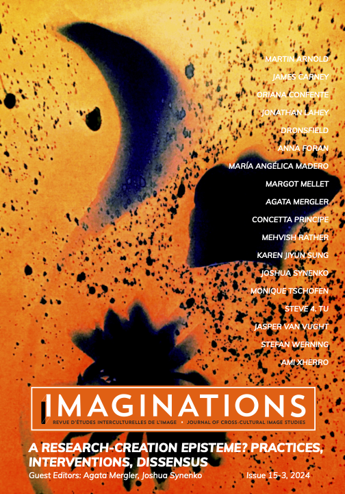
Following this successful conference, Dr. Mergler and I got to work on an editorial project inspired by contributions at the symposium, which we launched in partnership with Imaginations: Journal of Cross-Cultural Image Studies. This special journal issue includes 14 articles, including one by myself entitled “Let’s Abolish Research-creation.” The issue is now published.
I have also recently completed a second editorial project thanks to the initiative of my departmental colleague, Dr. Michael Epp, who in spring 2024 expressed an interest in collaborating with me on a special issue of Media Theory, entitled “Violent Labour and Media.” This project builds on a recognition of the fact that media, whether old or new, have been impactful when it comes to making workers comply with an agenda of perpetuating violence. Such a tendency can be found not only in labour practices that are directly equivalent to violence, such as work in the military, but also in sectors where perpetuating violence would not be considered a norm, such as education or service work or emotional labour in the context of families. The issue is geared to exploring perspectives on how media are implicated in the expansion of such “violent labour,” and to probing the specific role played by new technologies, whether they are borne from violence or from enhancing communications (or both). The issue is now published.

Current research
I received Trent University’s Early Career Researcher Award in 2026.
At this juncture, my research aims have branched into several different but connected paths:
1. Research in the arts: I am under contract with Concordia University Press to write a monograph on media arts research-creation histories.
2. Intersections between cinema and geography: I am writing an article on “ambient policing: citizen app, soft montage, and documentary criticism”, which builds on approaches in documentary filmmaking to examine the inclusion of crime-reporting apps and alert systems on mobile phones.
3. Scholar-led publishing futures: as Managing Editor of Media Theory responsible for financial matters, I devote considerable amounts of time on improving the journal’s sustainability and exploring alternative methods of open-access publishing.

